Warning: Some posts on this platform may contain adult material intended for mature audiences only. Viewer discretion is advised. By clicking ‘Continue’, you confirm that you are 18 years or older and consent to viewing explicit content.
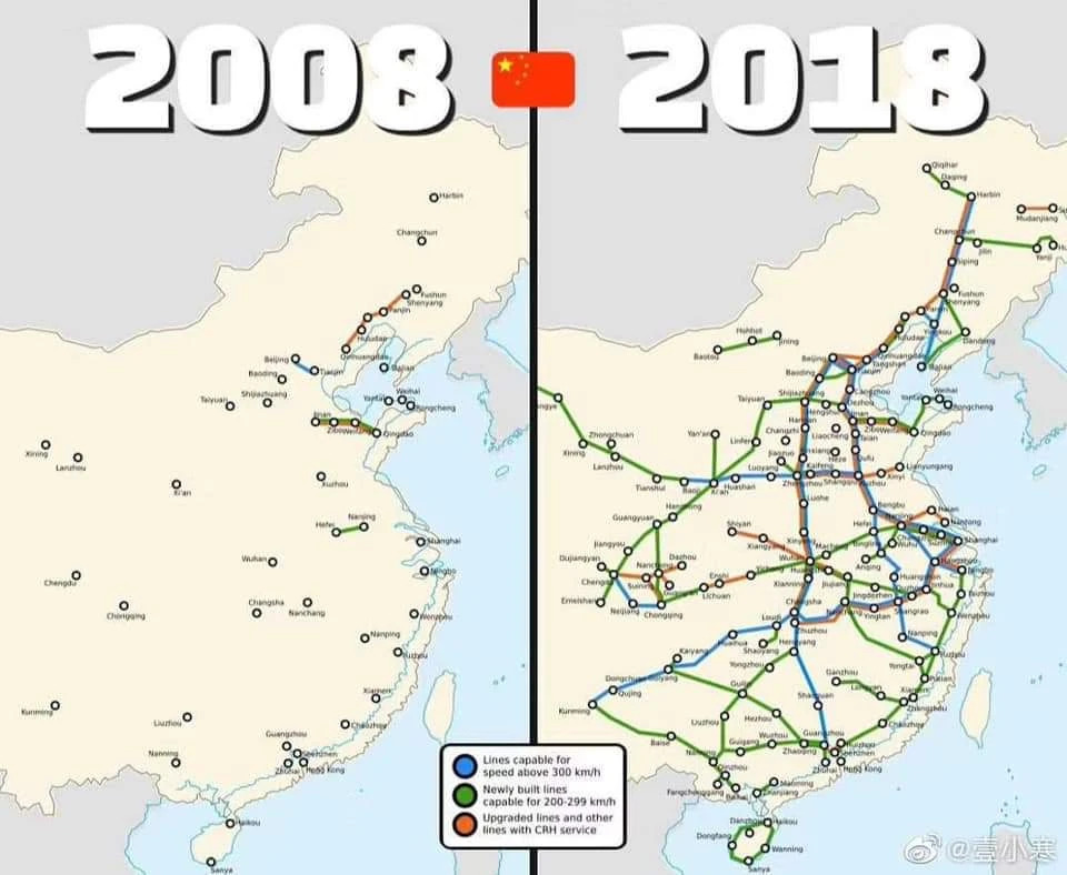
All the dark black lines should be train lines. This shows all types tho, not just the high speed ones. But honestly for general commercial and social prosperity, the regional lines are probably more important than the high speed long distance ones. If you go over to Europe while using this layer, it will get very dense.
Yes
May we see it?
No
:(
For a more detailed view at all rail infrastructure the transport layer on osm is nice: https://www.openstreetmap.org/#map=7/29.845/113.676&layers=T
All the dark black lines should be train lines. This shows all types tho, not just the high speed ones. But honestly for general commercial and social prosperity, the regional lines are probably more important than the high speed long distance ones. If you go over to Europe while using this layer, it will get very dense.
Edit: this ones is a bit more nuanced http://cnrail.geogv.org/enus/about